
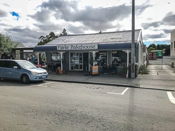
I thought I’d come to New Zealand to escape the heat, but with the mercury touching 30 degrees today, I guess I was wrong. We had a big day of driving planned, and we started our day in Geraldine with a full breakfast provided by John, our host at the B&B. I still have to say that I am unsure whether I like this mode of accomodation. This one was very well appointed and there was great attention to detail, but I still feel like I am staying at some uncle’s house. From Geraldine we drove to Fairlie which is where Deb’s sister in law’s family come from. They used to run the pub in town and now some cousins run the bakery, so we made a compulsory stop for morning tea.
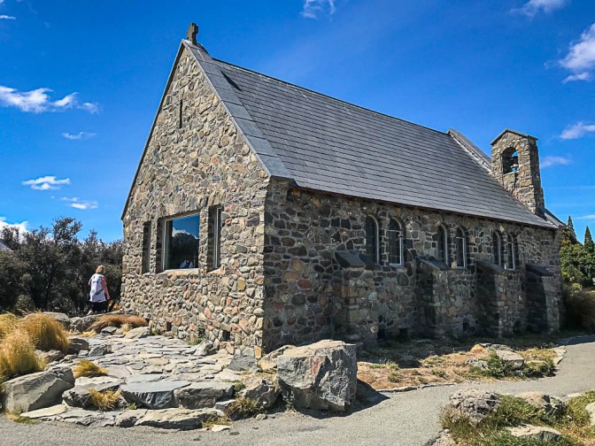
From Fairlie there’s a bit of bendy driving until we arrived at Lake Tekapo. Apart from the Lake, it is known for the ‘Church of the Good Shepherd’ which was built in 1935 and was the first church in the Mackenzie district.
 Lake Tekapo itself provides water to the Tekapo A Hydro power station that was originally opened in the 1951 and refurbished in 2008. It now has generation capacity of 25 MW.
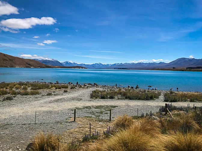
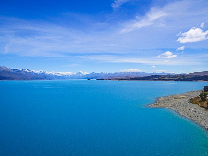
Most of the shops in Tekapo were shut for New Years Day, so we got back on the road. The next stop was Lake Pukaki, which is another one of the lakes that were dammed to support the New Zealand’s hydro schemes which now generate the bulk of power used. At the far end of Lake Pukaki is Mount Cook, New Zealand’s highest mountain. I tried to get some drone photos, but I think Mt Cook is a bit far away (about 70 KMs) to seek clearly … but I tried.
We stopped for lunch in Twizel, a town that was built in 1968 to service the Waitaki Hydro scheme that built canals to link all the lakes and power stations. It was intended that the town be closed in 1983 following project completion, however a successful local protest ensured the town remained and it now serves the local tourism industry.
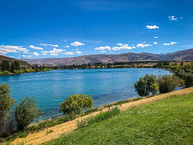
From Twizel we drove over the Lindis Pass into Central Otago. The scenery on this drive is spectacular as you wind your way through the valleys to Comwell at the bottom end of Lake Dunstan which is part of the Clyde Hydro scheme that dams the Clutha River. With the temperature pushing 30 degrees most of the potential drone flying spots were pretty busy, so given my developing skils, I decided not to be a public nuisance, instead opting for an Ice Cream in Cromwell.
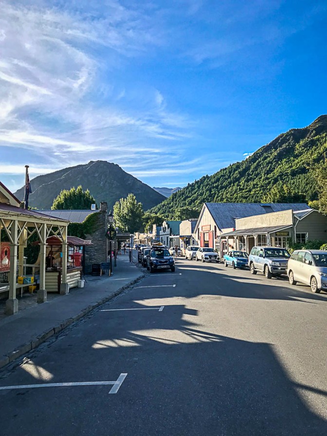
From Cromwell we drove towards Queenstown and stopped off in Arrowtown for early dinner. Arrowtown sprung up when gold was discovered in the Arrow River in 1962 and the town quickly grew to a population of 7,000 at the peak of the Otago gold rush. It is now a quaint tourist town with lots of shops selling expensive stuff you probably don’t need.
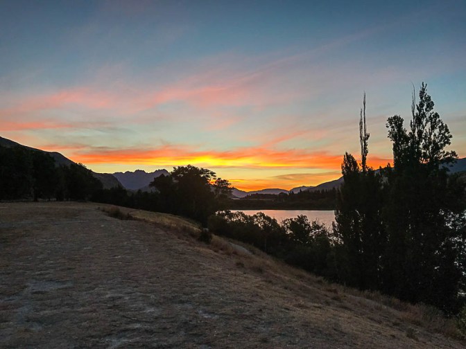
We are staying in Deb’s cousin’s house at Lake Hayes for the next couple of nights and given tonight was clear, we went down to the lake to watch the sunset. Now that we are a long way south, it means that sunset takes a long time and wasn’t really over until 10pm… a far cry from Brisbane where it’s dark by 7 in Summer.
Until tomorrow!
